


Convensa and FCC Construcción are using geospatial technology to build the Rubi Line of the Porto Metro (Portugal)
Convensa and FCC Construcción are using geospatial technology to build the Rubi Line of the Porto Metro (Portugal)
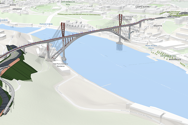
FCC Construcción and Convensafueron were awarded the contract for the new Rubi (H) line of the Porto Metro, between Casa da Música and Santo Ovídio. The project, worth more than €379 million, represents the largest undertaking of the Recovery and Resilience Plan in Portugal signed to date.
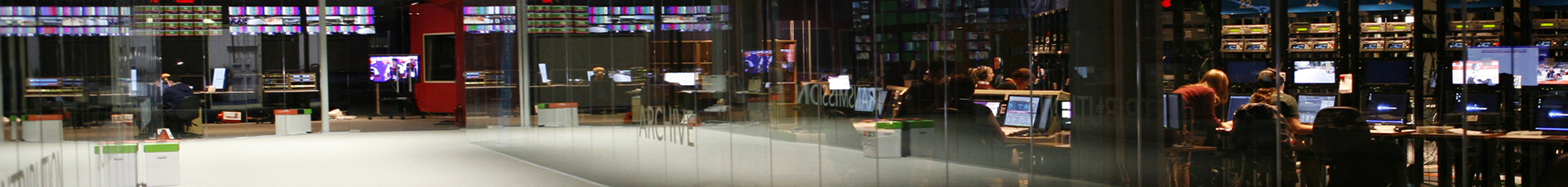
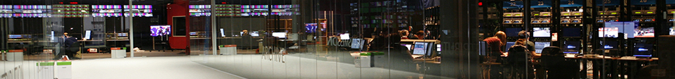
This project, which has established itself as a clear example of innovation within the AEC sector, was presented at the Esri International Infrastructure Management & GIS Conference (IMGIS), one of the most important events in the AEC sector worldwide, where the company has reported to more than 1,000 professionals on the use of cutting-edge technological solutions such as GIS-BIM flows and digital twins, among others, to expand a metro network that carried 79 million people in 2023.
Digital twins, virtual representations of the real world that include physical objects, processes, relationships and behaviours, and which allow the functioning of the territory and infrastructure to be replicated in a controlled and scaled environment, have been used in this project to visualise, analyse and control all kinds of relevant parameters and processes such as work progress, generate 3D models from LIDAR point clouds and integrate with the GIS-BIM flow.
GIS and BIM: the combination that will shape the digital future of the AEC sector
FCC Construcción, as a leader in international infrastructure development, is at the forefront of technology in the sector, as demonstrated by the development of the Rubi Line of the Porto Metro, with the use of BIM methodology and Geographic Information Systems (GIS).
The project has an advanced technological integration system based on GIS-BIM flows that allows for the centralised and geolocated management of all construction models, as well as other spatial data sources related to the project, and the integration of data observed by external monitoring platforms. Through the ArcGIS platform and the Autodesk cloud, BIM models are automatically synchronised with real-time data, facilitating collaborative work between teams. In addition, thanks to LIDAR scans, 360º cameras and aerial photogrammetry, it is possible to generate high-precision digital twins, which are essential for technical monitoring and strategic decision-making.
In the words of Cristina Carrera, Team Lead Utilities & AEC at Esri Spain: ‘The use of digital twins with BIM&GIS information in an infrastructure project allows us to better understand and monitor the work, working in a collaborative environment, which translates into reduced times and costs and makes the management of project materials and resources more efficient.
By using an integrative system such as ArcGIS, which enables and promotes data and system interoperability and collaboration, it has been possible to better visualise and control the monitoring system composed of sensors such as inclinometers, piezometers and optical systems, among others, whose data can be consulted in a unified manner on a single dashboard and allow real-time observation of the progress of the work and the environment.
According to Jose Rafael Camacho Montes, Head of the Technical Office at Consorcio Linea Rubi: ‘The incorporation of GIS-BIM technology and reality capture tools, such as drones and 360º cameras, and the integration of monitoring data into a single platform has enabled us to take a qualitative leap forward in the management of complex infrastructures. Thanks to these solutions, we have not only improved the efficiency and control of the project, but also reinforced our commitment to the environment and sustainability.’
The environmental dimension at the click of a button
FCC Construcción and Convensa, using Esri technology, have been able to catalogue all the trees located within the project's radius of action and tag those that could be affected by the progress of the work and the degree of impact.
This information is accessible in real time and shared with the authorities and municipal services, facilitating joint decision-making. In addition, the inventory and monitoring process has been optimised through the use of mobile applications, which speeds up data collection, reduces errors and improves the traceability of actions. This tool not only allows for the planning of protection or transplant measures, but also helps to maintain a comprehensive view of the project's environmental impact.